
By Koaw - October of 2022,
Watch the video here or read the guide below!
Live in Boston? Need a break from the bustles of city life? In less than an hour’s drive you could be relaxing in the great outdoors of Cape Ann which includes Gloucester, Essex, Rockport, and Manchester-by-the-Sea.
Let’s talk about some places that I checked out that I believe are worth a visit!
I’ll offer tips like parking accessibility, trail difficulties, things to do, animals to see, and other fun tidbits.
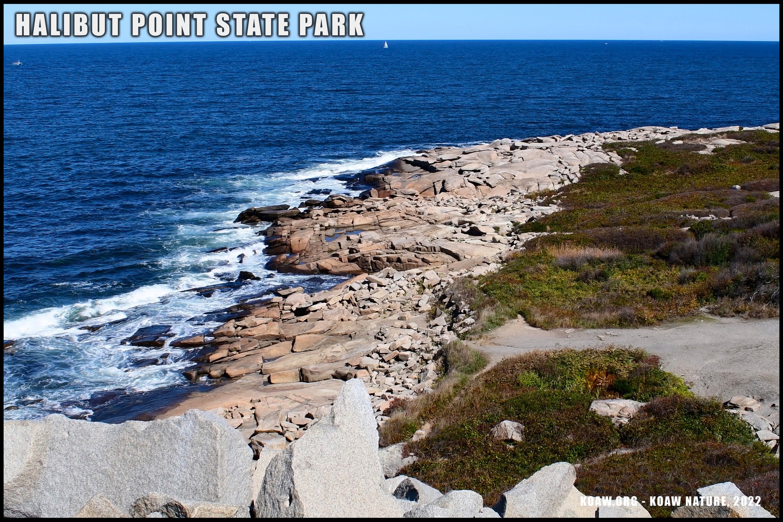
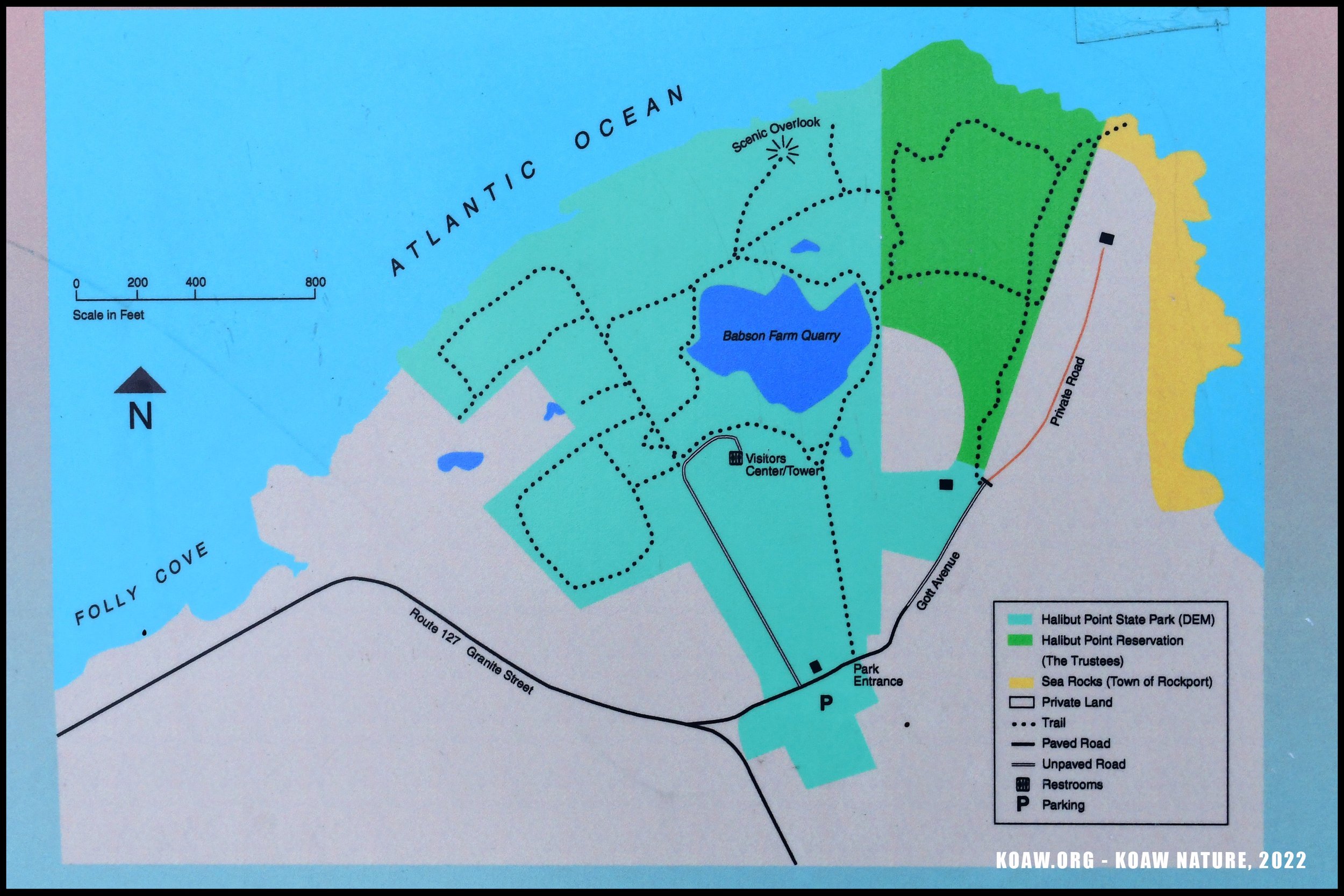
#1 - HALIBUT POINT STATE PARK
Light hiking/walking, scenery, historical spot, birdwatching, & fishing.
Halibut Point State Park is an easy yet rewarding outdoors place to visit.
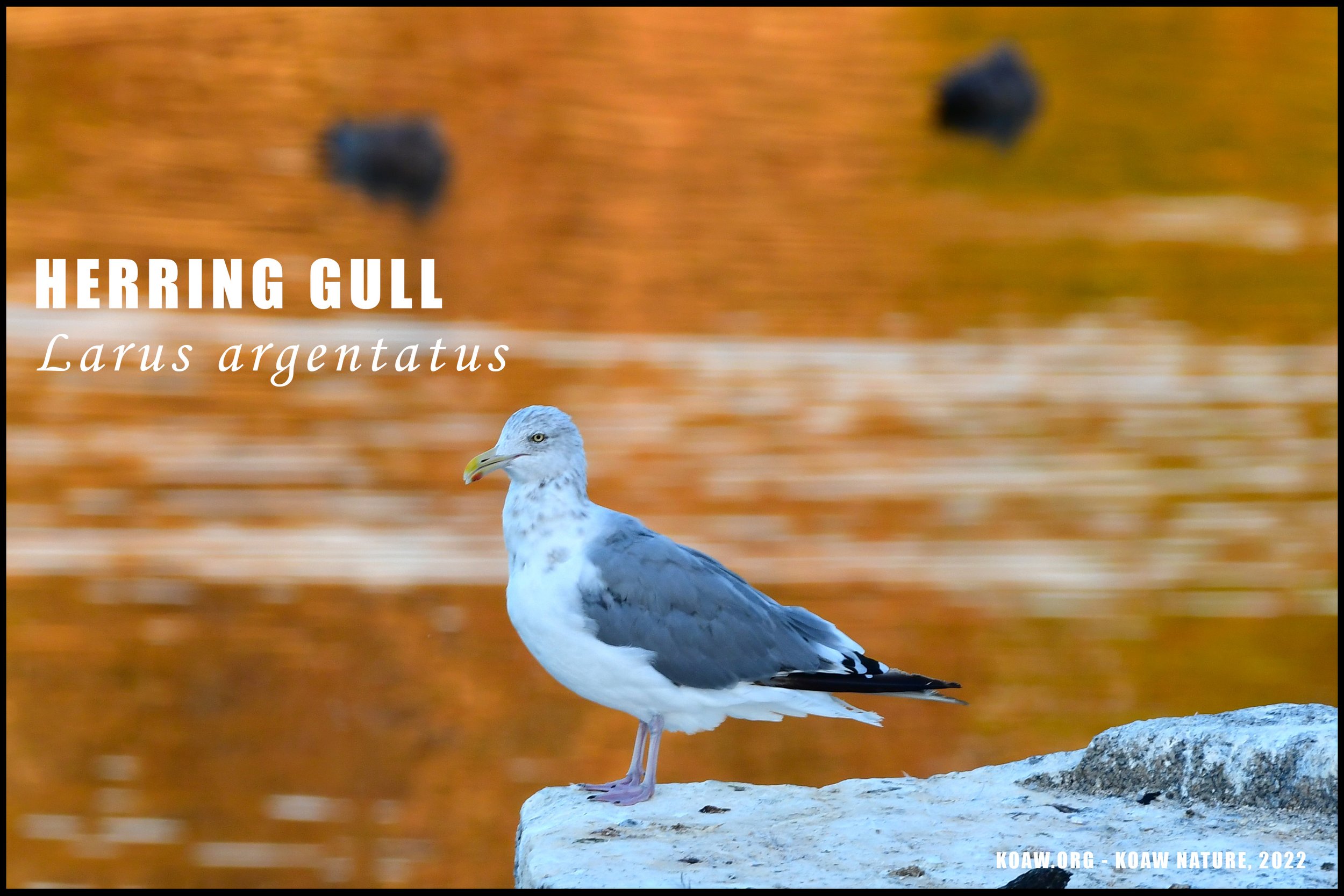
We’ll start with the easiest nature-outing that still has amazing scenery. Halibut Point State Park is at the very northeast tip of Cape Ann, specifically within Rockport. An easy trail leads you to a large, out-of-commission quarry, now full of water. This impressive sight of massive, flat cut stone is no longer used for harvesting granite but rather a hangout for gulls and other birds. (Swimming is not permitted in the quarry, sorry!)
TIDBIT: Though the Gloucester and Rockport area is well-known for its former and current fishing industry, the quarry industry once rivaled the fishing industry in this area. Check out the visitor’s station near the quarry to learn more.

Fishing is permissible but there is not an easy-access pier over the ocean. Instead, you’ll have to fish atop the boulders along the shoreline. Accessing the water requires an able-bodied person to traverse the large stones. The boulders extend far into the water, even at low tide, making for many snags for bottom rigs. You could try and catch large striped bass (Morone saxatilis) during May through October. Many large cunners (Tautogolabrus adspersus) found my line off of the rocks as well as many small Atlantic bonito (Sarda sarda.)
There also appeared to be no signage saying fishing wasn’t allowed in the quarry. Golden shiners (Notemigonus crysoleucas) were the one species I saw in there, other species likely exist.

Trails are very simple at Halibut Point State Park and most likely could be accessed by those in wheelchairs or using walkers.
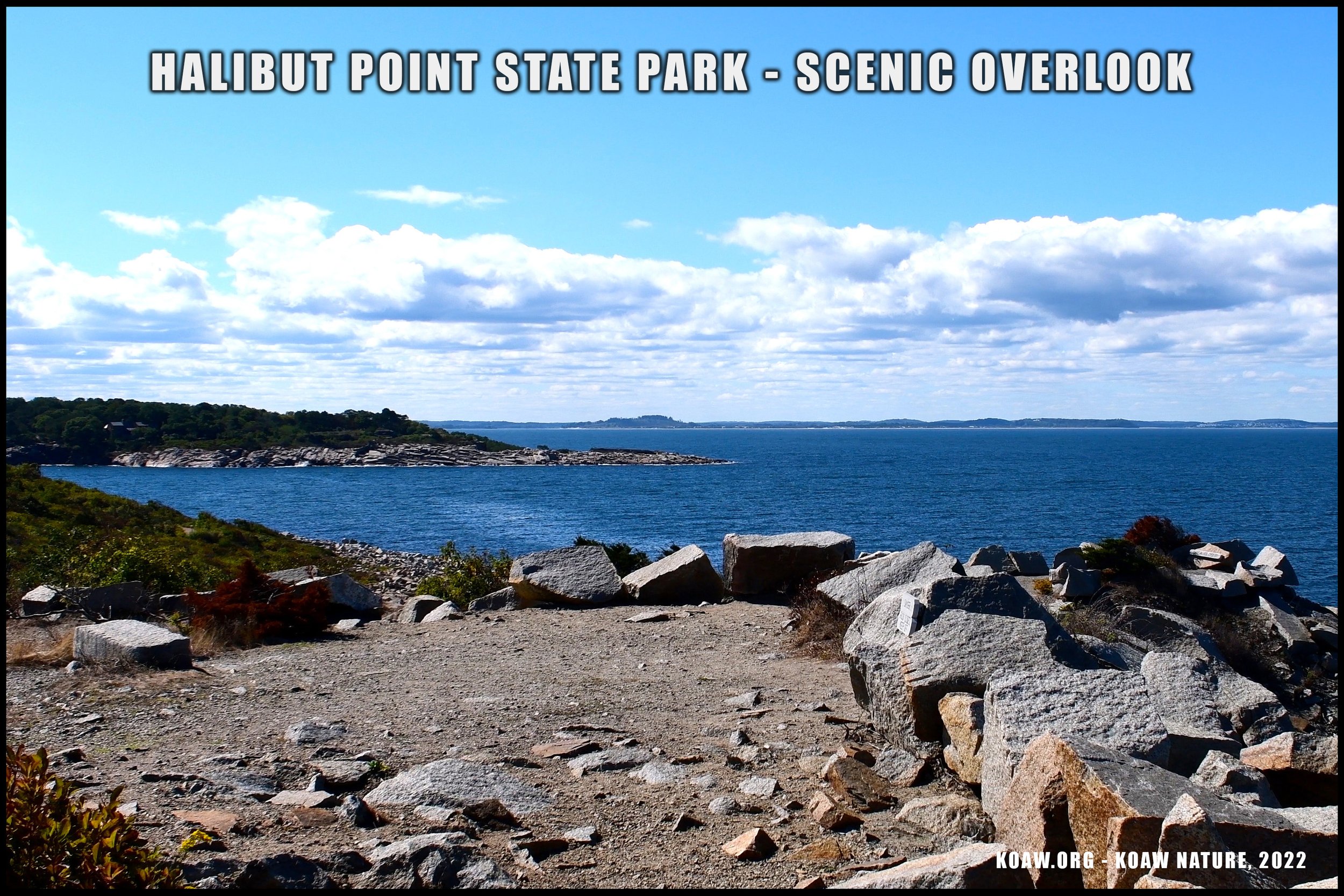
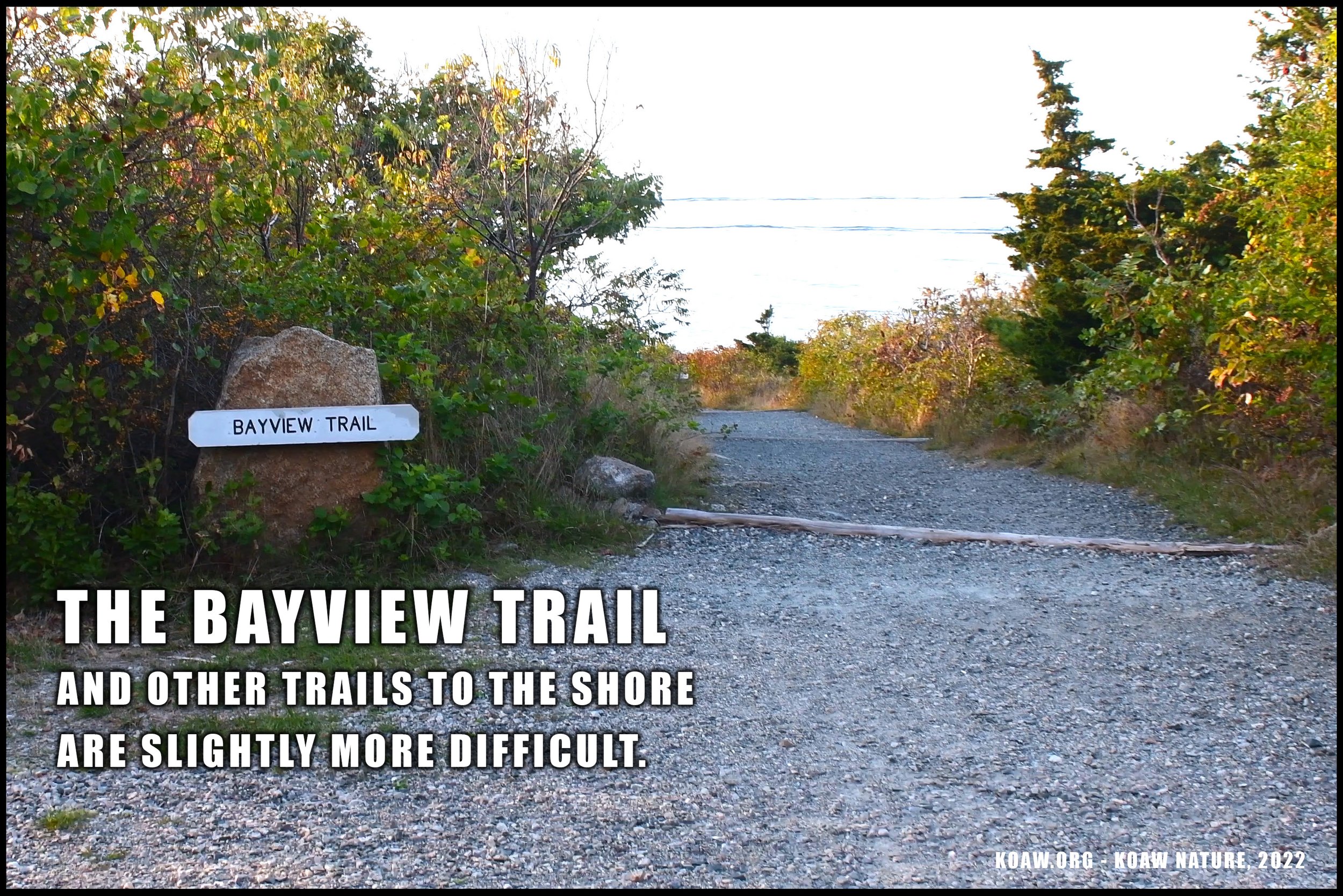
DIFFICULTY: Mostly easy with moderate sections. Persons in wheelchairs or using walkers could do the main trails at Halibut Point. Most trails are flat and well maintained to the quarry, though the small bits of gravel make it slightly more difficult for those using wheelchairs/walkers. Most individuals could make it with ease to the Ocean View Point that is about a half mile from the parking lot. Other trails to the boulder-laden shore offer moderate difficulty.
PARKING: There is a medium sized parking lot that may be full on weekends, especially in the summer months. Self-pay at the kiosk in the middle of the lot. It’s $5.00 for those with Massachusetts license plates and a steep $20.00 for those with out-of-state license plates. (Prices as of 2022 & likely to change in future years.) Paying for parking is typical only in the summer months and into fall.
Pay at kiosk in lot with credit card. Map Source: https://goo.gl/maps/DnrPjhfL6JZbtmtG7
PARKING ADDRESS: “4 Gott Ave, Rockport, MA 01966” or “Halibut Point State Park Parking Lot, Gott Avenue, Rockport, MA” works for Google Maps.
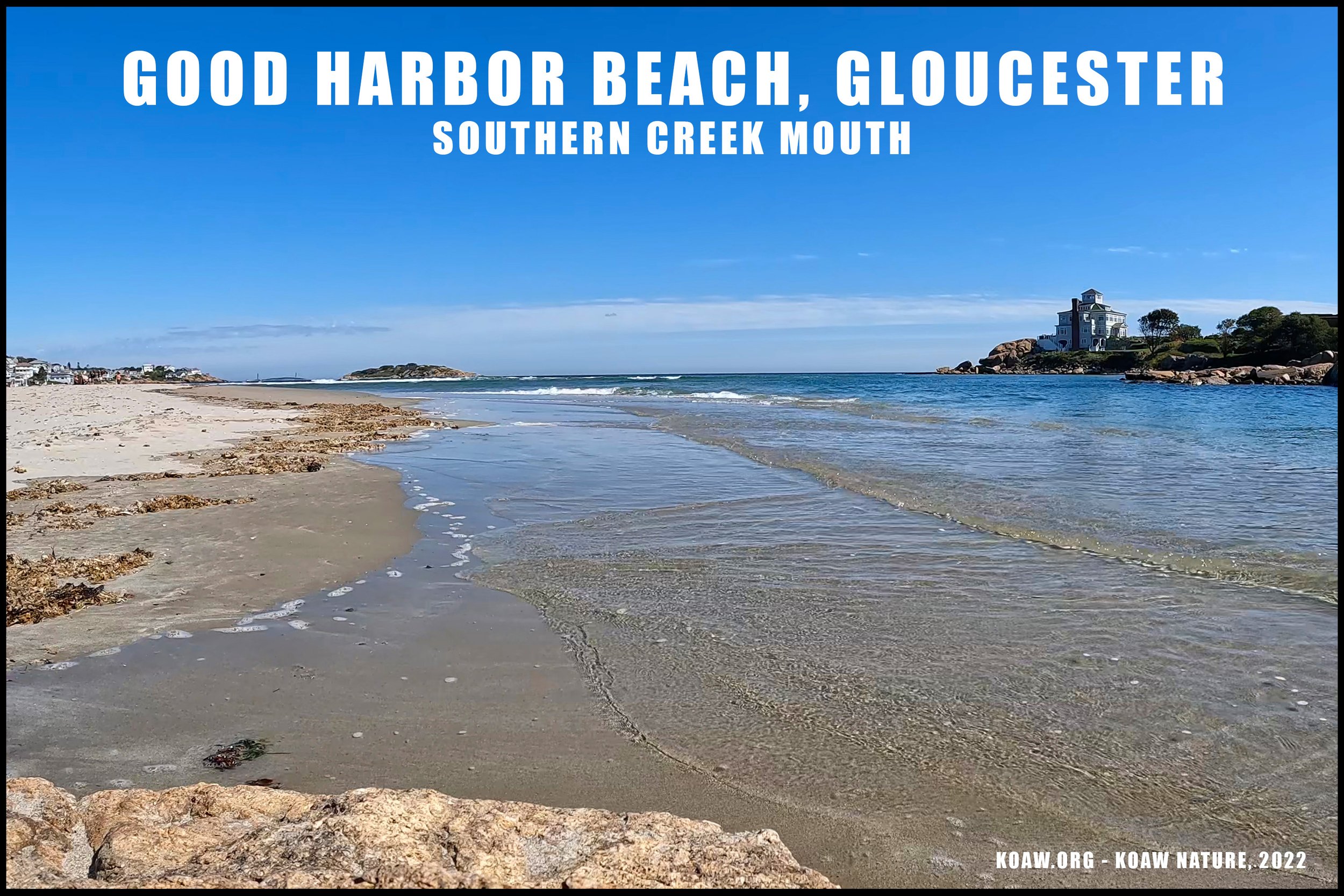
#2 - GOOD HARBOR BEACH
Swimming, surfing, chilling, fishing, & birdwatching.
Signage behind bathrooms at Good Harbor Beach.
This section of Gloucester’s shoreline is ideal for the beach bum. Unlike most all of Cape Ann’s boulder-ridden shoreline, Good Harbor offers one of the largest, sandy beaches in the area. Surfers and swimmers enjoy the waters while many people just soak up the sun over the warm sand.
During the summer months this beach is packed. If you are like me and not a fan of crowds, this beach is not for you. Although by mid-September, during my last visit, the beaches were not that crowded, but the water temperature was beginning to drop, making for a rather chilly swim. Even in the summer months, you’d be lucky to get water temps into the low 70’s.
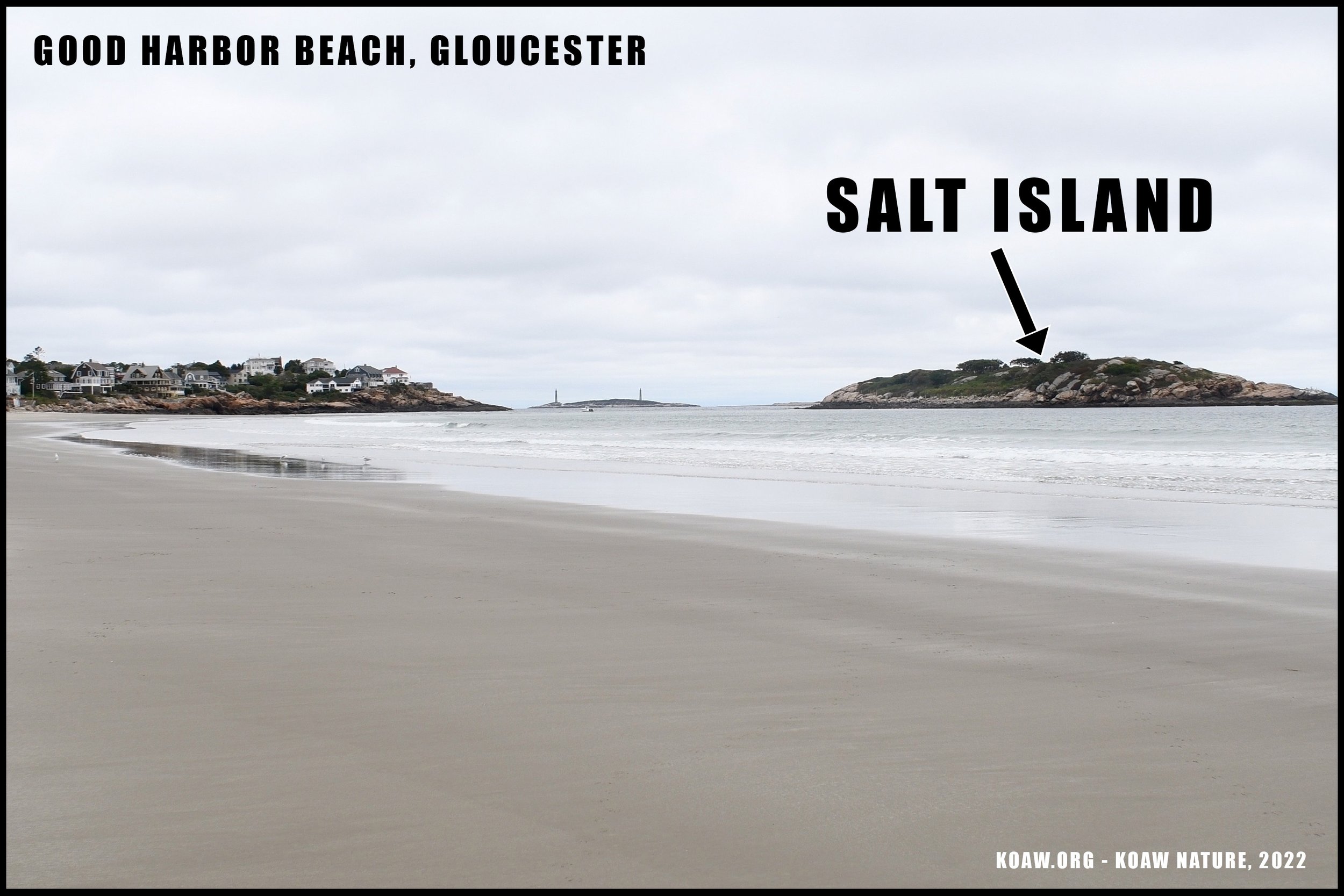
TIDBIT: The locals claim that during low tide you can walk out to Salt Island; (see the photo in the gallery.) The shallowest path will be from the north side of the beach (or at the left side if you are looking at the water.) Just don’t stay too long and get stuck when the tide returns!

Great egret eating mummichog in wetland behind Good Harbor Beach.
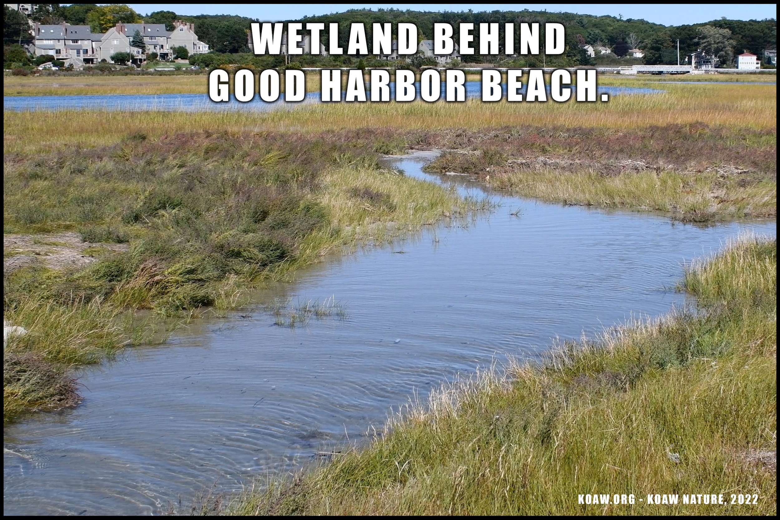
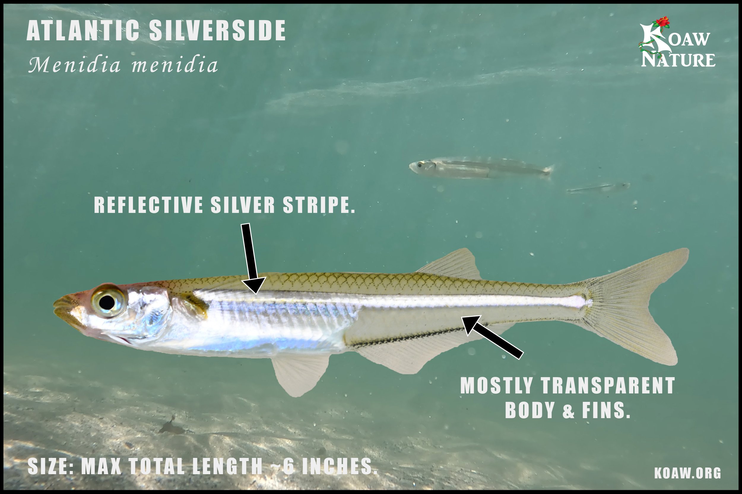
One of the real nifty aspects of the beach is the estuary behind the parking lot. You’ll see herons and egrets making meals of small fishes like the mummichog (Fundulus heteroclitus) and Atlantic silverside (Menidia menidia). You’ll probably see these little fishes along with other species swimming around in the shallow surf of the beach. If you walk to the south side, or far side of the parking lot from the entrance, there is a pathway that leads to a better view of this wetland.
Fishing is permitted (at least I didn’t see any signage saying otherwise.) However, finding a spot to set up a rig would be difficult on crowded days. I’d say shoreline anglers should avoid this spot during the summer months unless tucking against the far corners of the beach.
DIFFICULTY: It’s fairly simple and quick to get from the parking lot to the beach. Traversing sand is probably the most difficult aspect of accessing the beach.
PARKING: This beach is packed during the summer months. Residents should invest in a yearly parking sticker while non-residents must reserve a parking spot online at least 10 days in advance if arriving between Memorial Day weekend to Labor Day. To secure a parking pass you must visit the Yodel portal on the Gloucester township’s main website. (Parking along Nautilus Rd is not permitted, at least during the summer months.)
PARKING ADDRESS: “99 Thatcher Rd, Gloucester, MA 01930”
#3 DOGTOWN TRAILS & BABSON BOULDERS
Casual hiking, scenery, historical spot, & animal watching.

Galen Mook demonstrates his physical interpretation of this Babson Boulder.
Dogtown’s outdoors trails offer a calming, yet eerie walk in the woods. Dogtown was originally the Commons Settlement established around 1700. Over time, as more people moved to the coastline as the fishing industry grew, the population of the Commons Settlement declined and eventually took on the name Dogtown, possibly because of the number dogs wandering about post-Revolutionary-War. The area became abandoned in the early 1800’s and soon-after all the houses torn down, leaving only the remnants of cellars.[1]
Some say these inland woods are haunted, if you believe in that sort of thing. What’s more enticing about these woods are the large boulders etched with propaganda. These “Babson Boulders” were placed in the already-abandoned Dogtown by the eccentric entrepreneur Roger Babson so as to boost the morale of Cape Ann’s denizens during a time of economic struggles.
If you follow the Blue Trail-Babson Boulders you’ll be able to find each boulder, inscribed with different words. Some require going a bit off trail. If you’re not great at mental mapping, make sure you bring a compass or at least have your cellphone to pull up a map. The trails and trail-markings are not maintained too well but remain sufficient enough.

I describe these woods as a bit eerie because during my whole walk along the Blue Trail, I heard only two birds the entire time. Perhaps the birds think these woods are haunted too? The silence of these woods was as alluring as it was unnerving. It’s still a nice place to walk and bring a dog if you have one.
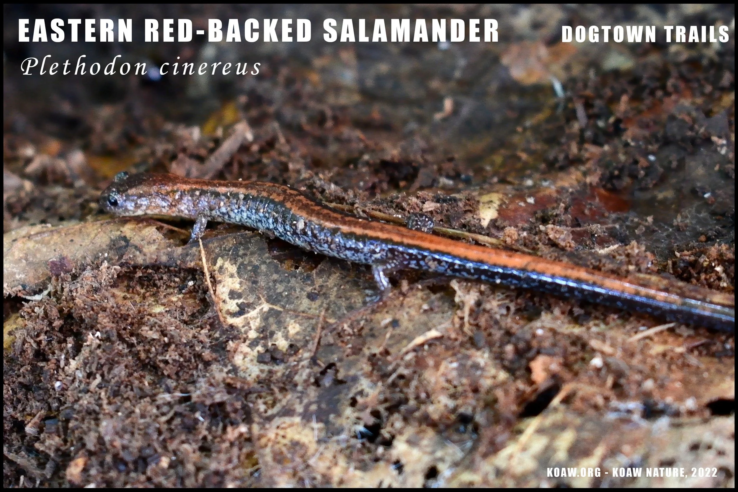
TIDBIT: You can find the Whale’s Jaw boulders by taking the Red Trail to the Yellow Trail. Also, a local mentioned that there may be more inscribed boulders on the more northeasterly trails; (of this I cannot confirm/deny.) However, along the Red Trail, you will find stones marked with numbers if you head in from the east parking. These numbered boulders mark old, abandoned settlements, supposedly where the ‘haunted’ aspect of these woods comes into play.
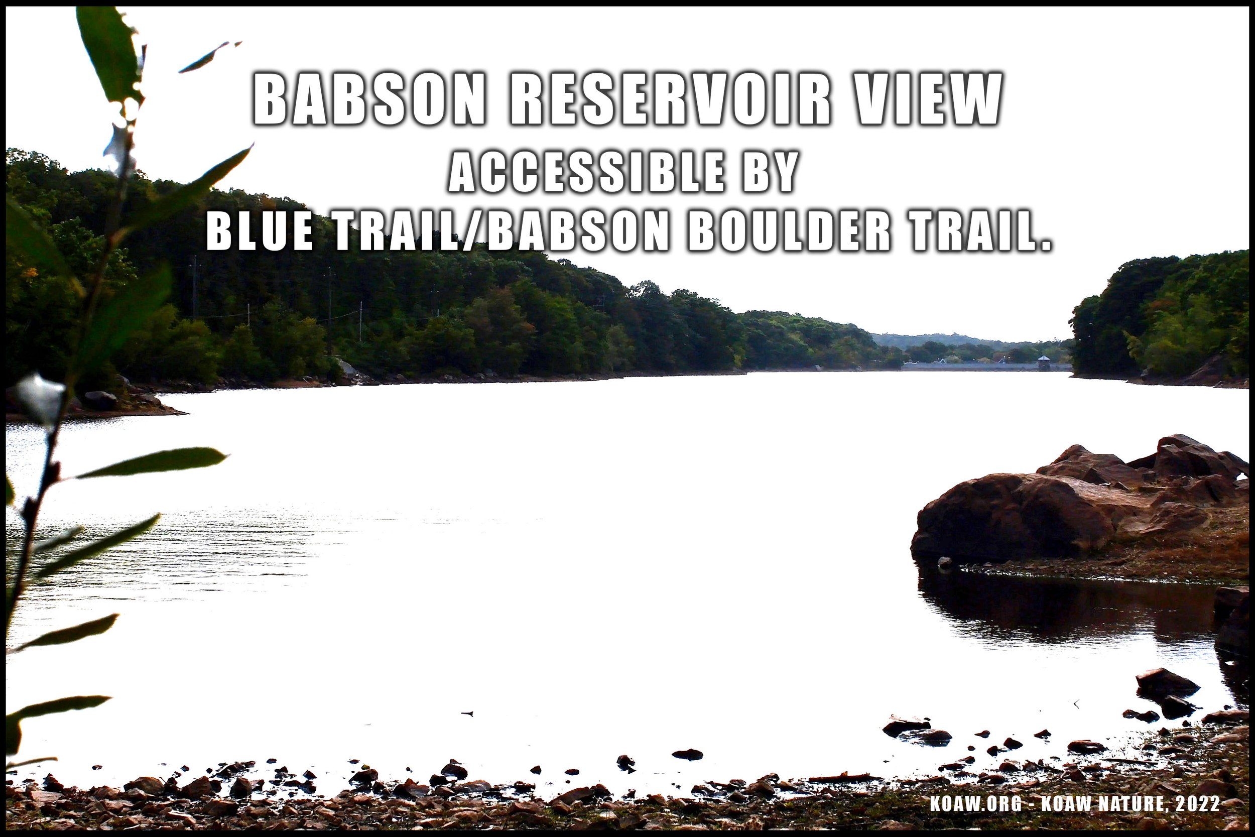
Fishing is not allowed at any of Gloucester’s reservoirs. (See Cape Pond below for nearby freshwater pond fishing.)
A downside of these woods is that there appears to be an amount of litter from reckless visitors, hunters, and makeshift homeless encampments.
DIFFICULTY: These trails vary from easy-and-flat to moderately difficult. This area would not be practical for people using wheelchairs/walkers. There are some inclines/declines that create moderately difficult areas in places. Certain areas require walking over bumpy, protruding boulders in the paths.
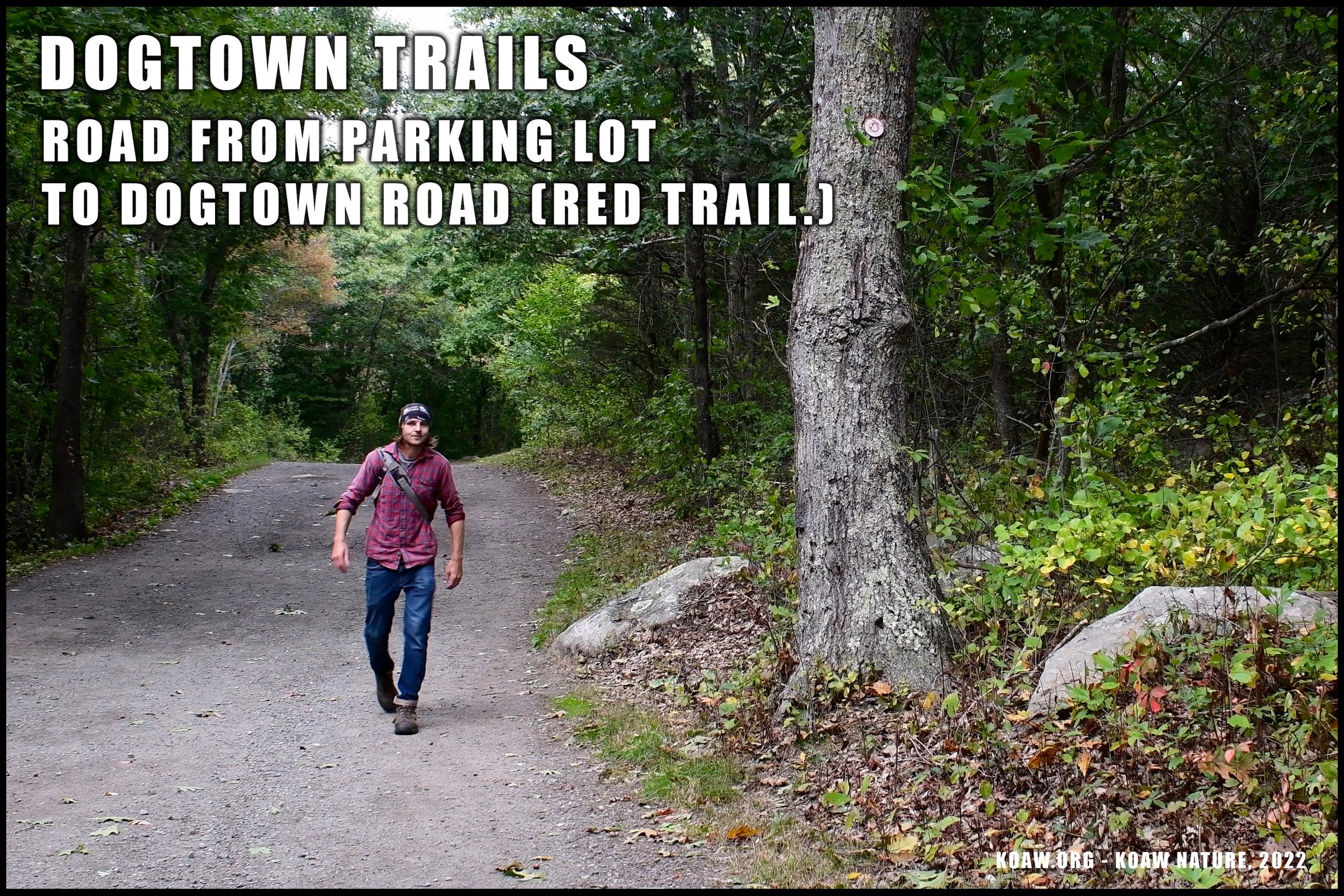
PARKING: The east entrance was free-of-charge and offered a very small lot with roadside parking unofficially available. There is a Dogtown Trailhead on the map south of the Babson Reservoir, but this entrance was blocked off and full of ‘no parking’ signs upon my visit in 2022.
PARKING PLUS ADDRESS: “J8MM+J9 Gloucester, Massachusetts”.
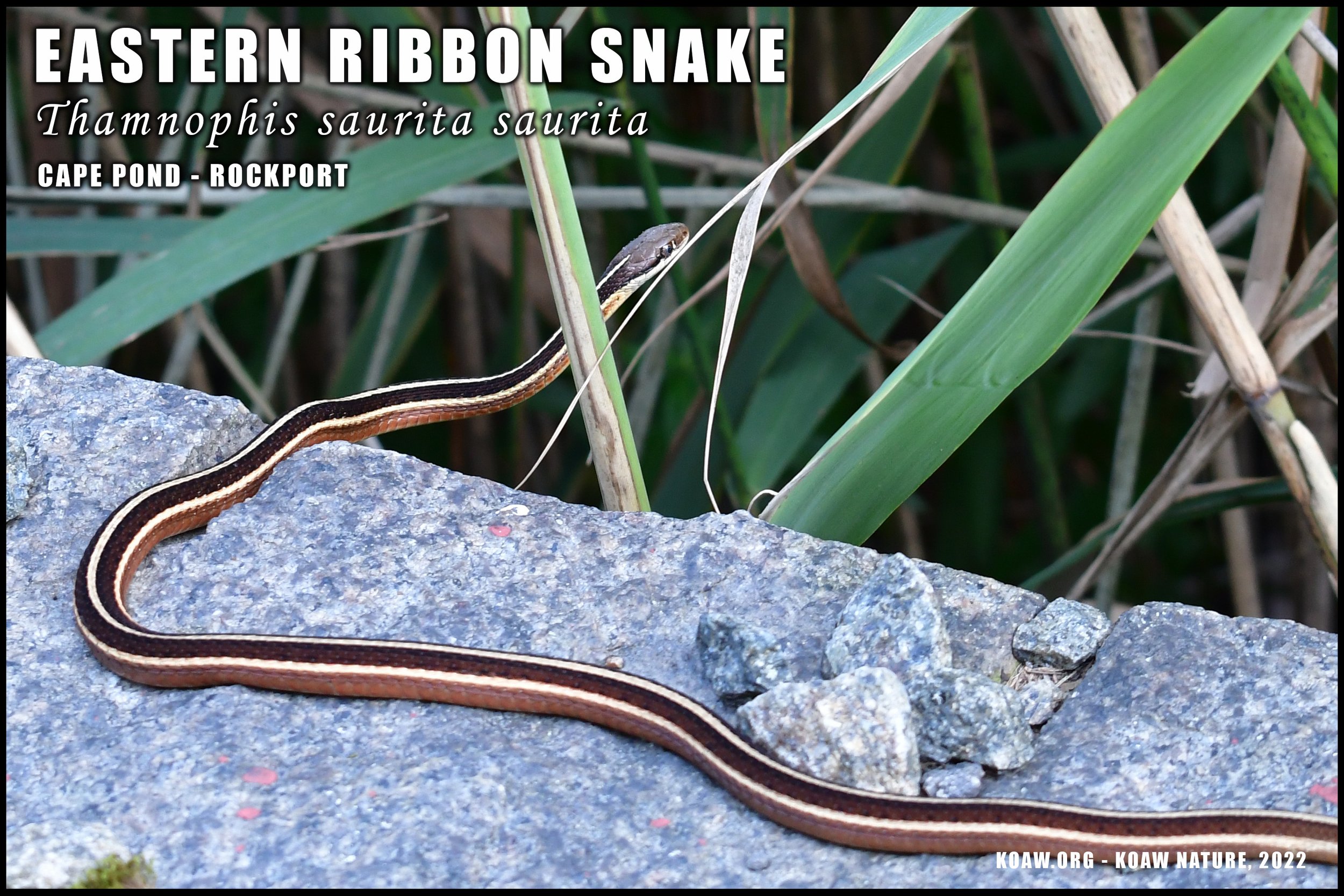
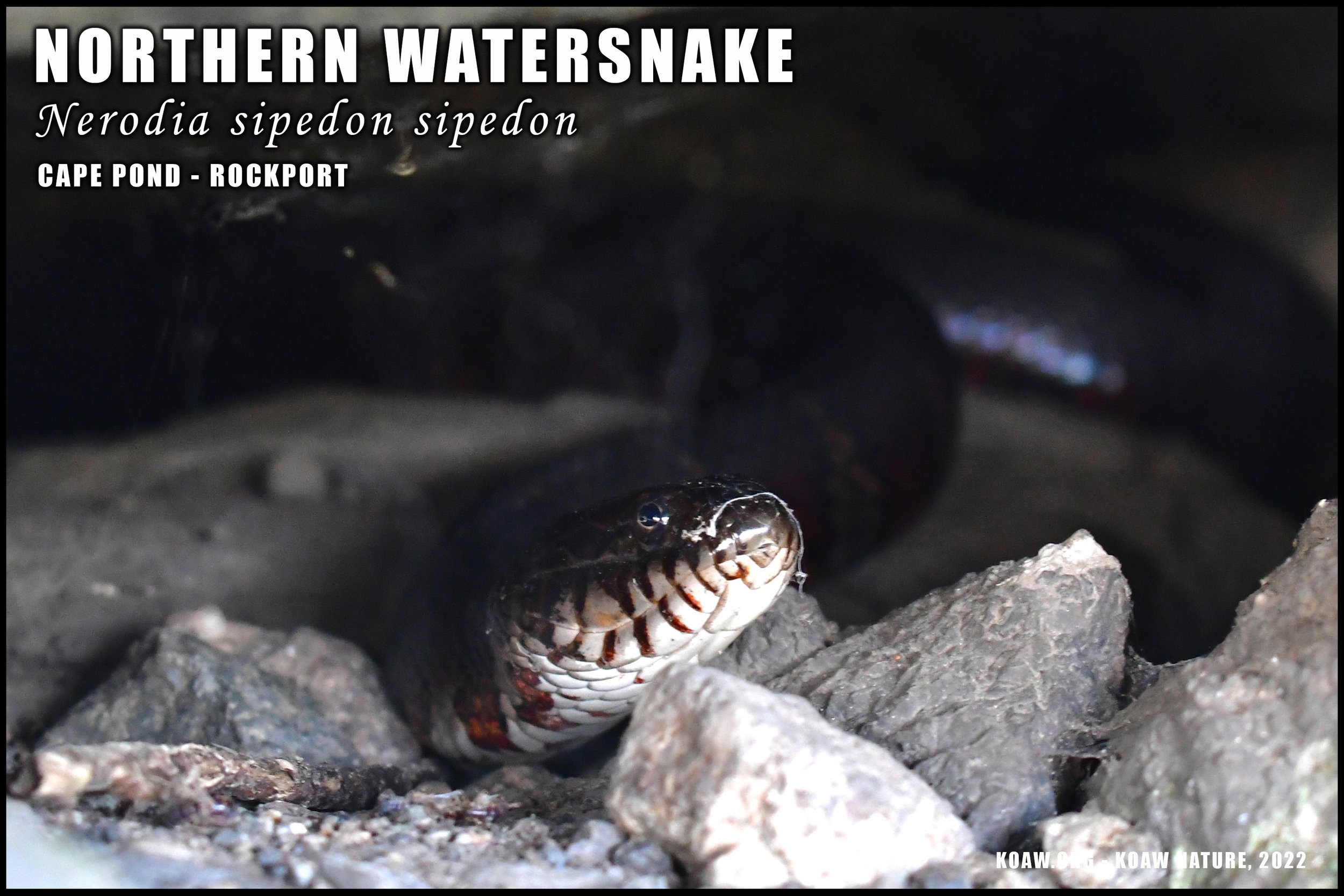
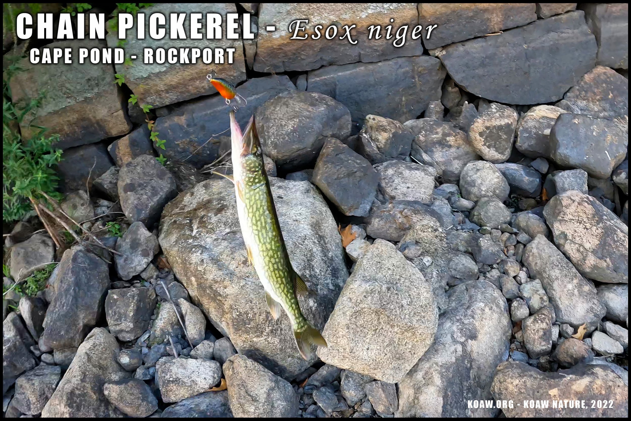
#4 CAPE POND AT ROCKPORT
Casual hiking, scenery, fishing, & animal browsing.
Cape Pond is a hidden spot within Rockport that offers a quaint walk down to and then along a rather large pond/reservoir. There’s nothing too extraordinary or extensive about this area—it’s a nice spot nonetheless. The surrounding woods are very peaceful, offering a lot of wildlife for viewing.
Cape Pond is an ideal spot to take the kids fishing for a chance at some largemouth bass (Micropterus salmoides) and chain pickerel (Esox niger). Herpers, or those who look for reptiles and amphibians, will be able to find a variety of species here as well. Look for northern watersnakes (Nerodia sipedon sipedon) basking on and in between the rocks along the pond. There aren’t any ‘dangerous-to-humans’ snakes in this area.
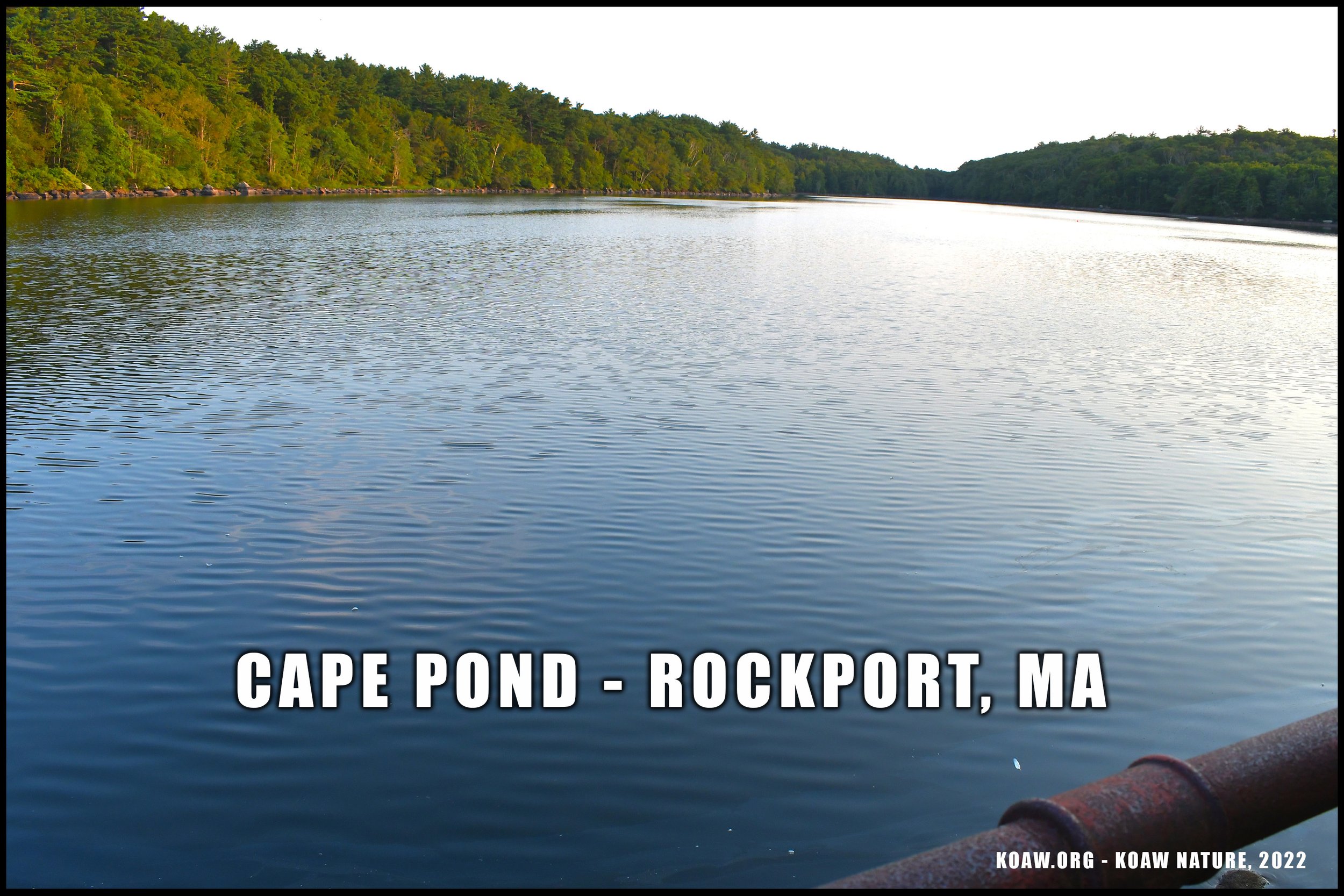
I’m fairly certain that fishing is permitted as there was no signage suggesting otherwise. However, swimming and boating was distinctly posted as being prohibited.
DIFFICULTY: There’s about a quarter-mile walk from the parking lot to the edge of the pond. The way to the pond is paved yet offers very steep declines. I’d label the area as easy to moderate to access.
Click to enlarge.
PARKING: Parking appears to be available and free of charge. Acquiring a parking spot here is sort of iffy as Rockport seems to want cars with resident stickers at most nature locales. However, right near the police station there are a few spots with no signage suggesting parking wasn’t allowed; (see the adjacent map.) The two times I parked here the officers came and went from their nearby facility without any argument to the presence of my out-of-state rental car.
Also, there is another parking lot adjacent to Main St. at the Visitor’s Center that may be usable. As always, park at your own risk.
PARKING PLUS ADDRESS: “J9VC+V3G Rockport, Massachusetts”
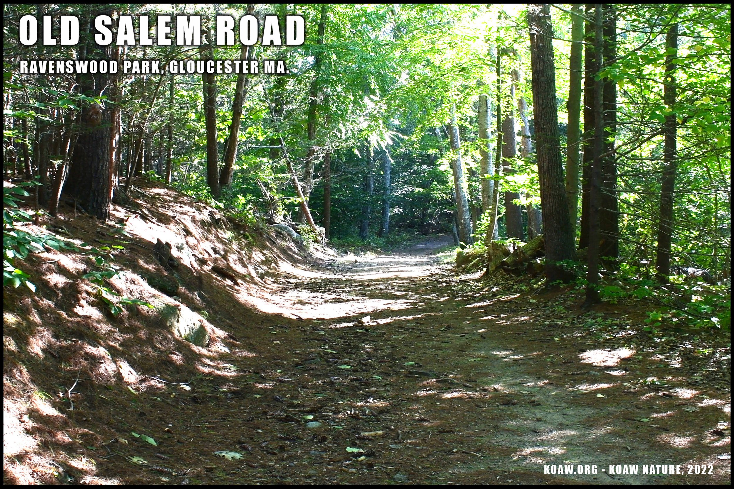
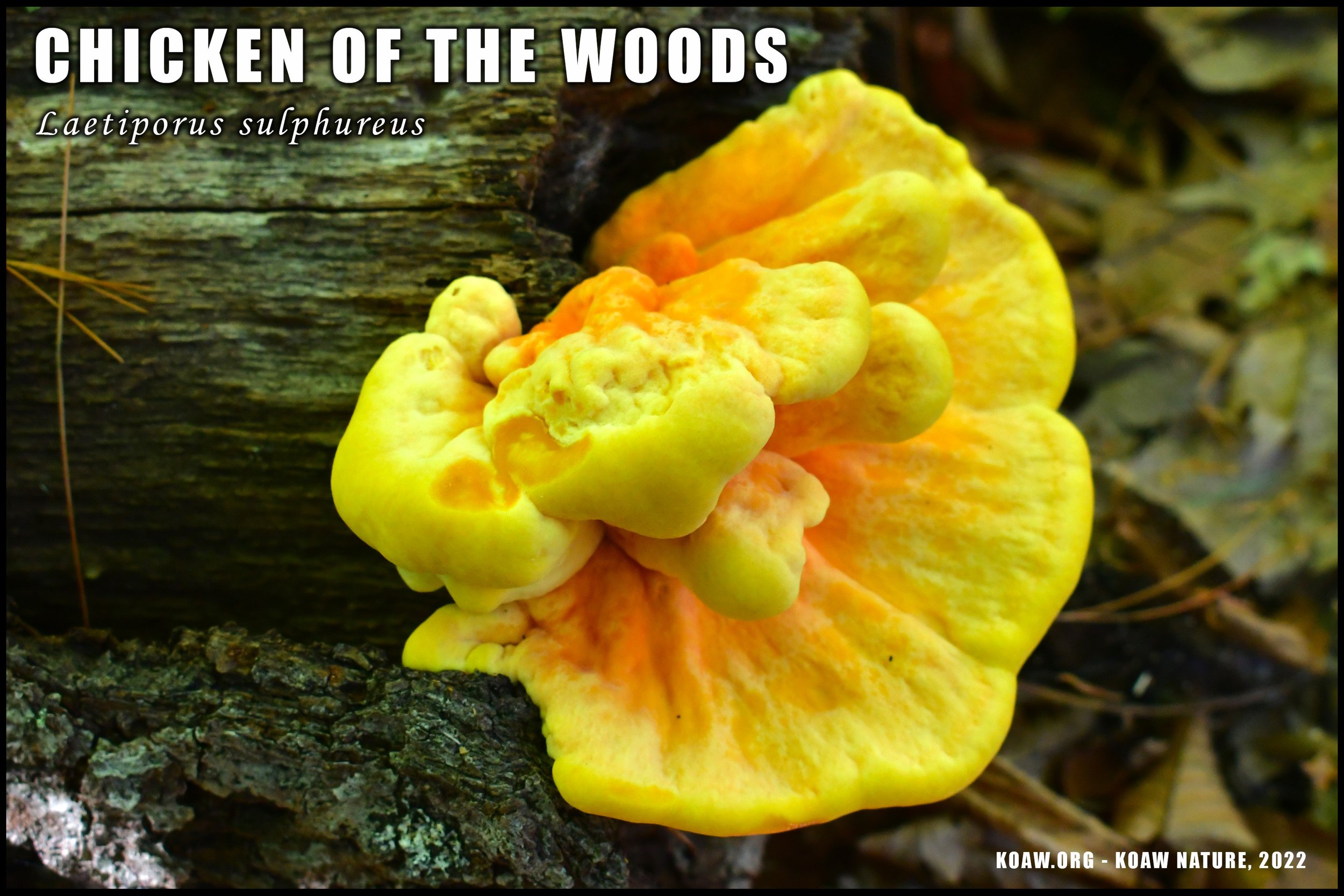
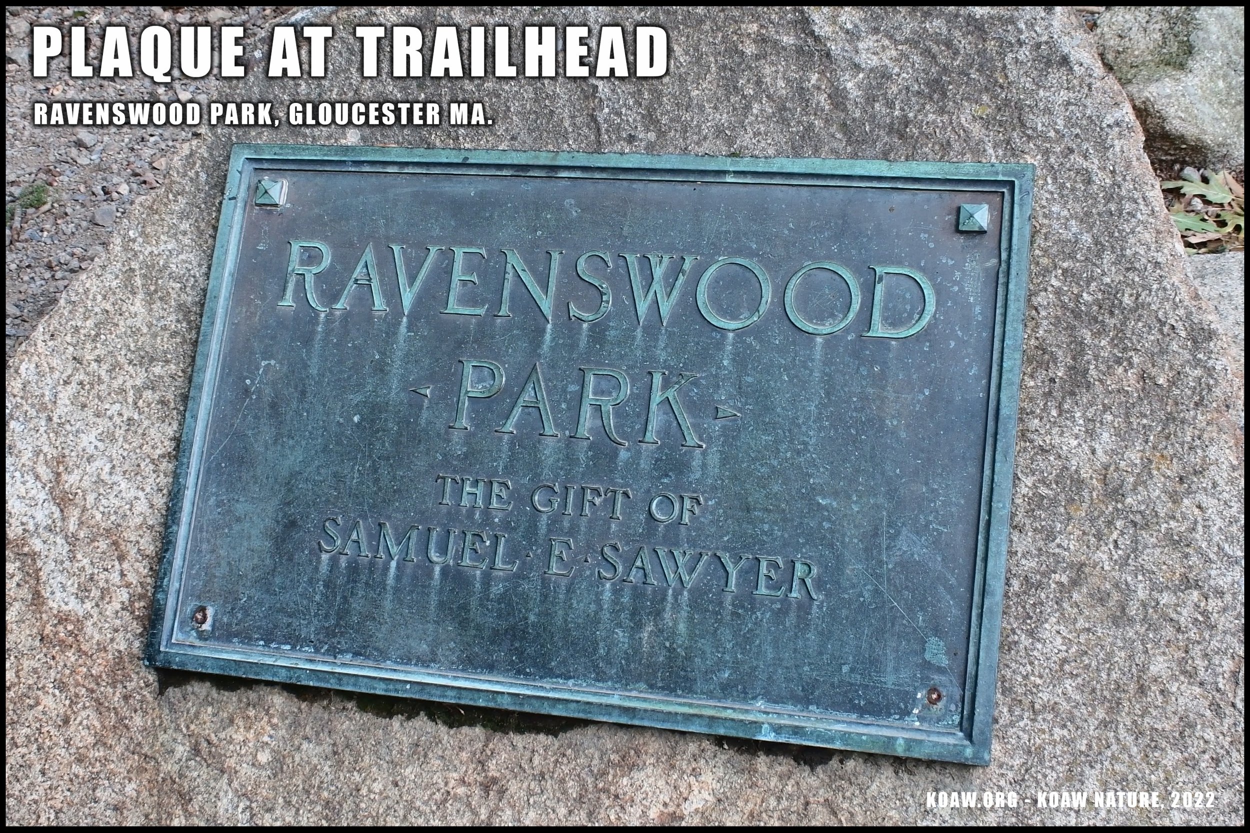
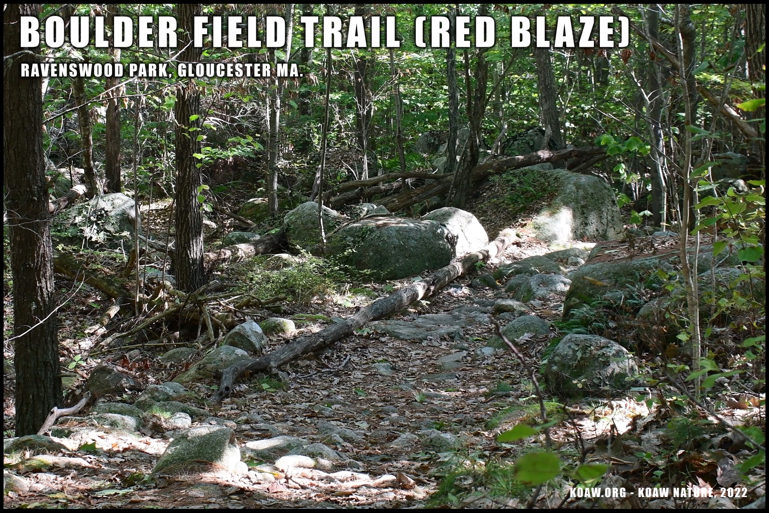
#5 RAVENSWOOD PARK
Casual hiking, biking*, scenery, historical spot, & animal browsing.
This pocket of woods is over 600 aces, just inland from the ocean. Go here for relaxing walks with the family or go solo for a tranquil hike. There are a number of trails, each offering different levels of difficulties and scenery. A handful of dog-walkers and joggers were enjoying the trails during my visit. Snowshoeing seems to be a popular winter activity here.
One aspect of Cape Ann that I love are the plethora of boulders riddling the landscape. There’s no shortage of crevices for animals to use and fun little spots to find a high perch for a mid-hike snack.
Upon my last visit in 2022, Massachusetts was in a severe drought. The Great Magnolia Swamp (Magnolia Swamp Trail) was the driest swamp I’d seen in a long time. The other vernal pools within Ravenswood were all dried up—or nearly dried up. I would imagine the drought has stunted some of the amphibia populations. But hopefully upon your next visit you’ll hear a lot of frogs and/or see some nifty salamanders.
Mountain biking is allowed only during certain months and on designated trails, of which, I assume are posted at the trailhead. Mountain biking is prohibited here during the wet season from March 1st to April 30th.
Click to enlarge.
TIDBIT: If you follow the Old Salem Road you’ll run into the Hermit’s Plaque. This sign pays tribute to a naturalist and author who built a cabin in these woods to study the wilderness. This “hermit” authored books on nature and taught visitors about woods. [2]
DIFFICULTY: The Old Salem Road path is relatively simple. For perspective, I witnessed a woman pushing a twin baby stroller fairly deep into the woods along this path. Other trails will offer more difficulty, such as the Boulder Field Trail that is full of boulders and steep inclines/declines.
PARKING: It’s free of charge to park at the Ravenswood Park main entrance. Open sunrise to sunset all year. See the park owner’s website of these woods for updates and more information. The small parking lot off of 127 fills up quickly in the warmer months.
PARKING PLUS ADDRESS: “H8R2+WM Gloucester, Massachusetts”.
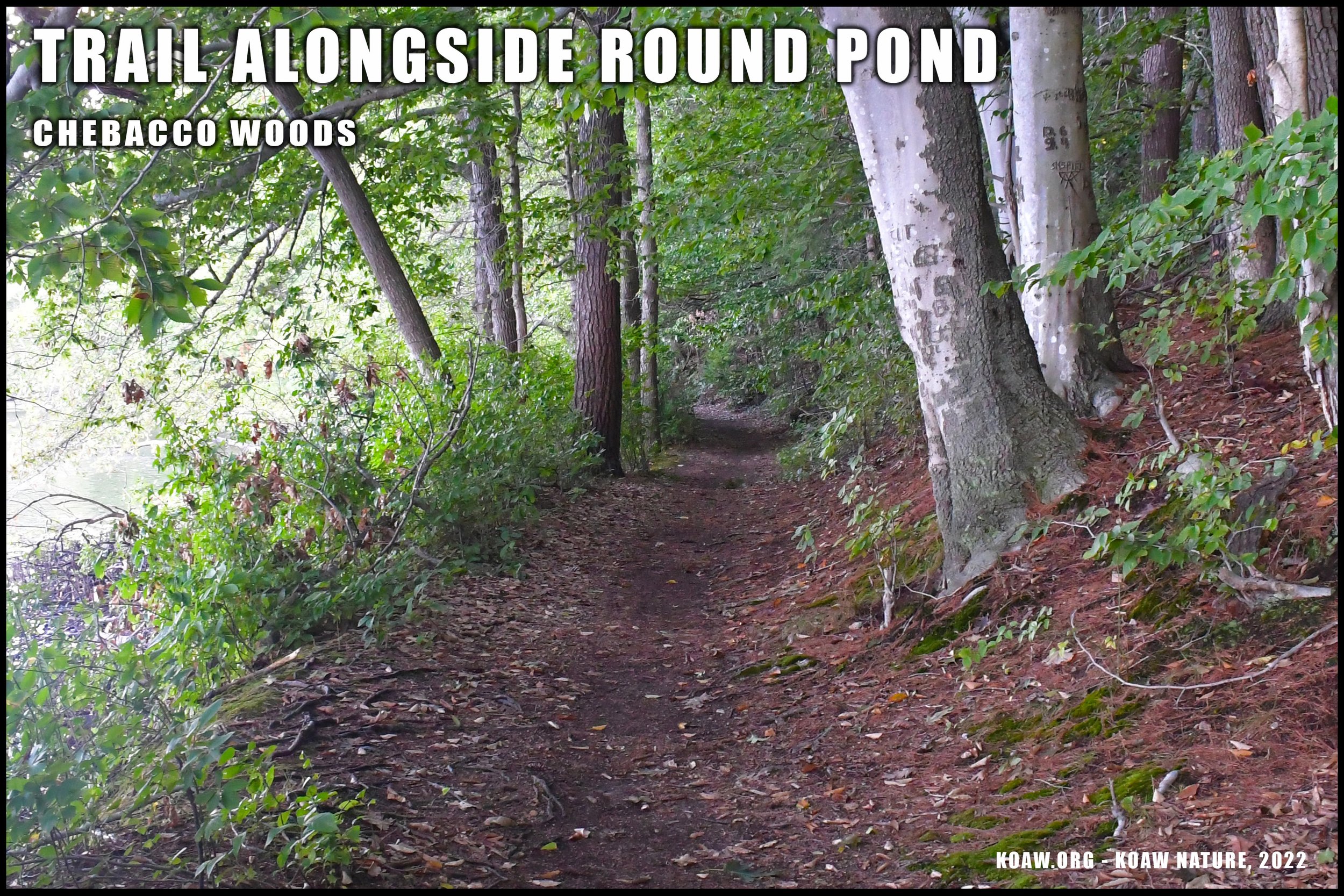
#6 CHEBACOO WOODS
Casual hiking, biking, fishing, scenery, & animal browsing.
Enjoy a nice hike in the woods and along the large ponds with trails that extend from Chebacco Road to the local University. There are 113 acres to explore. Mountain bikers and runners enjoy these trails as well as many casual walkers. (This park is joint owned by Hamilton and Manchester-by-the-Sea.)
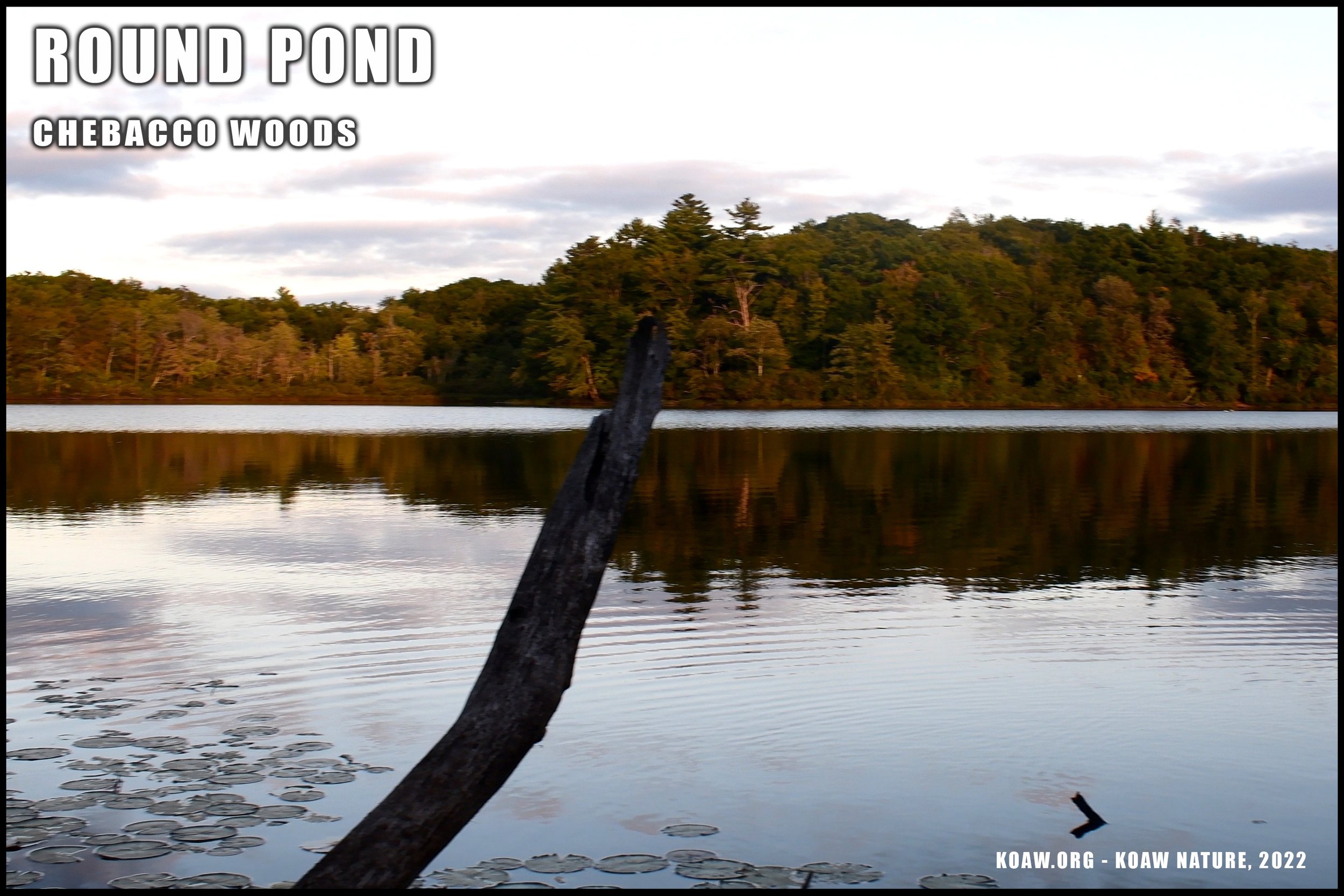
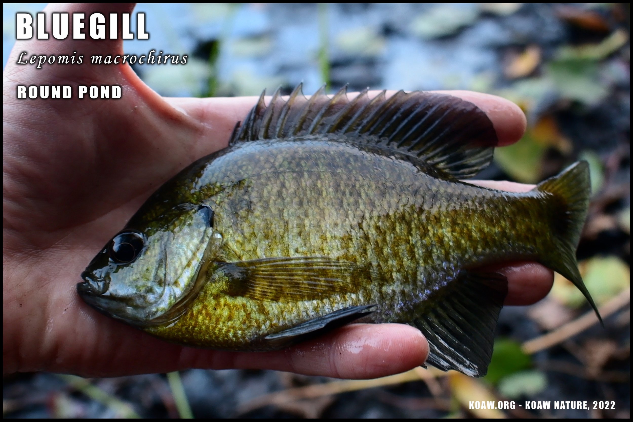
I stumbled upon these serene woods when I was looking to find a new inland fishing spot. Round Pond is the only pond that allows for fishing. Anglers can find largemouth bass, chain pickerel, pumpkinseed, yellow perch, and bluegill in this pond, if not other species as well. Non-motorized boats are allowed on Round Pond.

Herpers can have a go finding local amphibians and reptiles. This is a good area for birdwatchers too as the habitat-transitions offer for the arrivals of different species as well as the presence of non-migratory denizens.
TIDBIT: There’s a tiny little beach called Chebacco Lake Beach that offers a sandy beach on a nearby lake. During the summer months this would be a nice spot to chill. Find the small beach at this plus address: J53P+9Q South Hamilton, Hamilton, MA.
Find updates about these trails at Chebacco Woods | Essex County Trail Association (ectaonline.org). I’ll host their free-for-viewing Chebacco Woods trail map here for download (.pdf) in case their links become unavailable.
DIFFICULTY: Moderately difficult. Trails seem to be well-maintained but offer many ups-and-downs. Heavy rains will make many sections of the trails muddy.
Click to enlarge.
PARKING: There were more than a few tucked in parking spots off of Chebacco Road at various spots. The main lot has the arrow in the adjacent map. There was no fee for parking. One reference said parking was available at the nearby college on the southern side (see trail map) but when I arrived at Gordon College it seemed as if parking was only for faculty/students. As always, park at your own risk.
PARKING ADDRESS: J52H+85 South Hamilton, Hamilton, MA
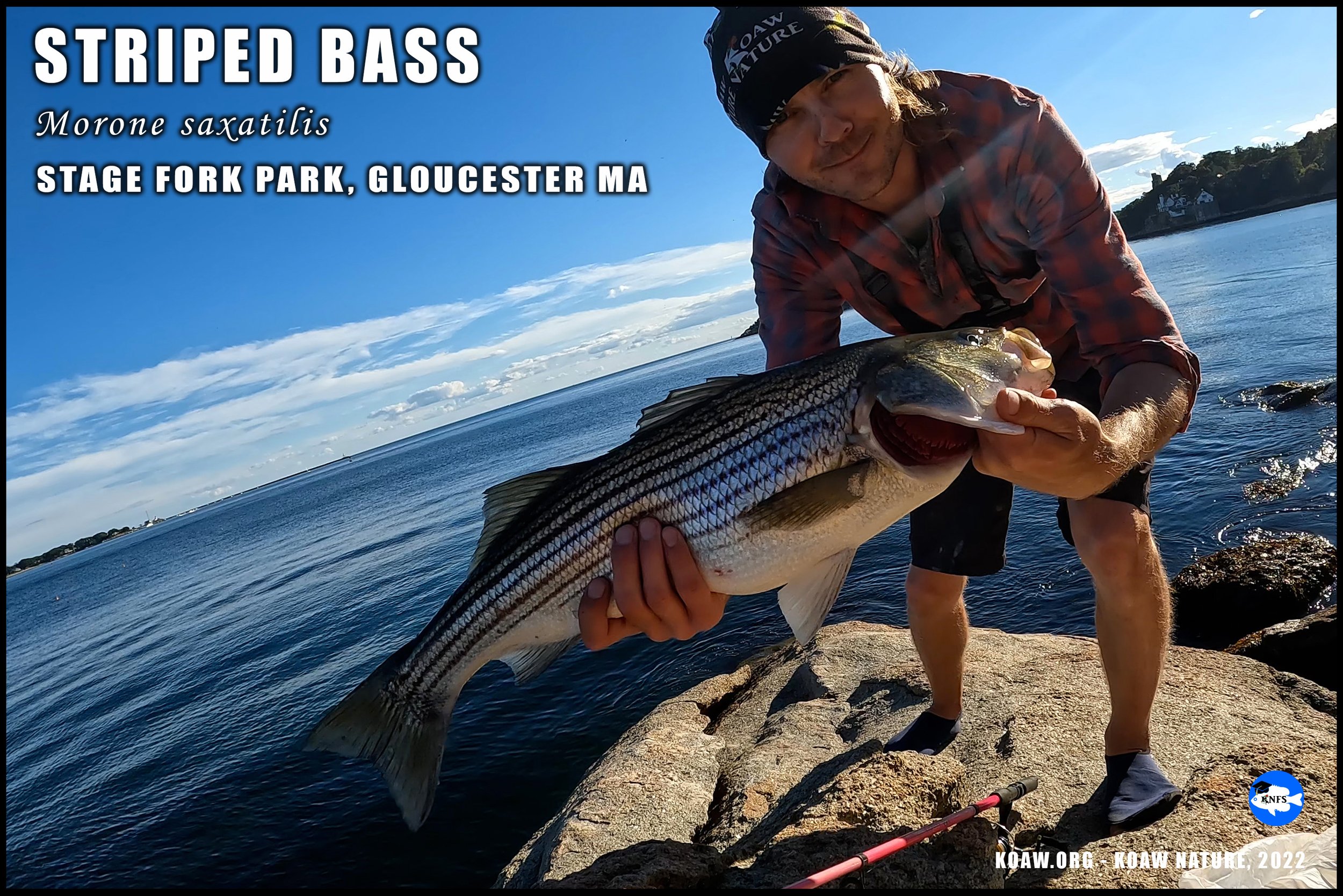
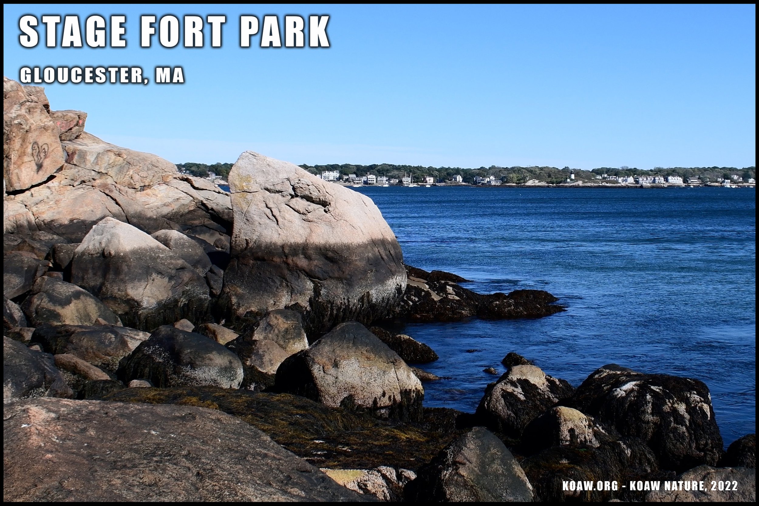
#7 STAGE FORT PARK
Walking, scenery, historical spot, picnicking, fishing, swimming, + more.
Cressy Beach is seen behind the boulders at Stage Fork Park.
Stage Fort Park offers a little bit of everything. This area offers a great way to get outside without having to trek far from the amenities of civilization. There’s a dog park, baseball field, volleyball court, small beaches, visitor center, bathrooms, and playground.
There’s also a variety of historical significances to this locale. Native Americans arrived at this area thousands of years ago, presumably to set up fishing grounds. More recently, from 1623, this location marks Gloucester’s first European-descended residents. You can find antique cannons that still remain atop the cliffy shoreline looking over Gloucester Harbor. Frankly, I wasn’t paying too much attention to the historical bits here so you can delve into that for yourself if you so wish.
Half Moon beach is an itty-bitty beach snuggled between the rocks. This would be a nice spot to bring the kids for a somewhat ‘enclosed’ beach. The larger Cressy Beach is just to the south and will only have a sandy beach to rest upon when the tide is low otherwise it’s rocks and seashells.
Fishing is possible from the beaches or atop the boulders of the shoreline. I caught some striped bass (Morone saxatilis) and plenty of Atlantic bonito (Sarda sarda) off the rocks between the beaches. The swim I had at Cressy Beach in late September was chilling, to say the least. Though, on the bright side, I had the whole beach to myself.
DIFFICULTY: This park is very easy to maneuver around in most locations. A person using a walker or wheelchair would be able to access many of the features offered here, including the Visitor’s Center.
PARKING: Between Memorial Day and Labor Day there are parking fees. Non-residents must apply online 10 days in advance to reserve a spot (just like a Good Harbor Beach.) Make reservations through the Gloucester’s governmental portal. Gloucester residents should invest in a yearly parking pass.
PARKING PLUS ADDRESS: J83C+X8 Gloucester, Massachusetts
REFERENCES/FURTHER READING:
[1] M. J. Carlotto, The Cellars Speak, CreateSpace, 2015.
[2] T. T. o. Reservations, "Ravenswood Park History," [Online]. Available: https://thetrustees.org/content/ravenswood-park-history/. [Accessed October 2022].
[3] Parking map references pulled from Google Maps: 2022. Google Maps